
The Swiss Soil Information System NABODAT contains soil data from cantonal soil protection offices and some national projects. Further cantonal datasets are being harmonized and migrated to NABODAT on an ongoing basis. An extract of the released point data is periodically made available in the Swiss Soil Dataset, in the current version 7 (December 2024).
The Swiss Soil Dataset contains soil information collected from boreholes and profiles from soil mapping projects, as well as soil data from cantonal implementation of soil protection measures according to the Swiss law regulations (composite soil samples, see soil sampling manual) and long-term soil monitoring done by national and cantonal soil protection agencies are available. Users can access various measured values and parameters of the analysed soils. However, soil pollutant data is excluded from the data set for legal reasons.
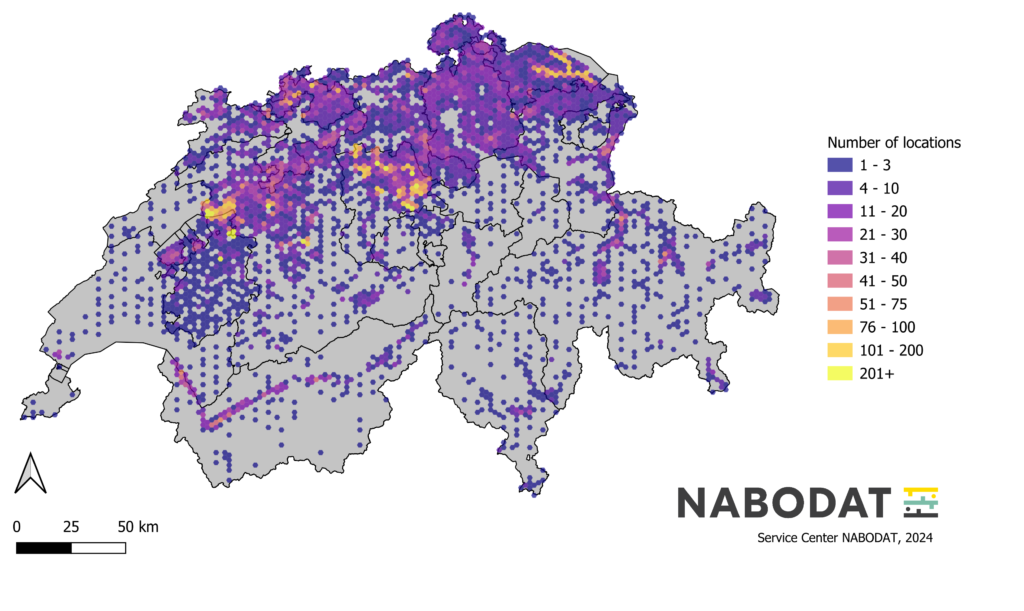
The point data from the soil mapping, soil protection and monitoring projects of the last decades is not spatially representative for Switzerland. The Swiss Soil Data Set (version 7) contains soil data for around 42’000 survey sites distributed across the country. Profile data from the survey for the Swiss Soil Suitability Map and monitoring data from the Swiss Soil Monitoring Network (NABO) complete the data of the cantonal soil protection agencies.
Download
Order the Swiss Soil Dataset
To order the soil data set, please complete the form below. Please take note of the documentation and the integrated FAQ describing the Swiss Soil Data Set. The documentation is part of the data delivery.